


Dinosaur Trail, Sierra Espuña
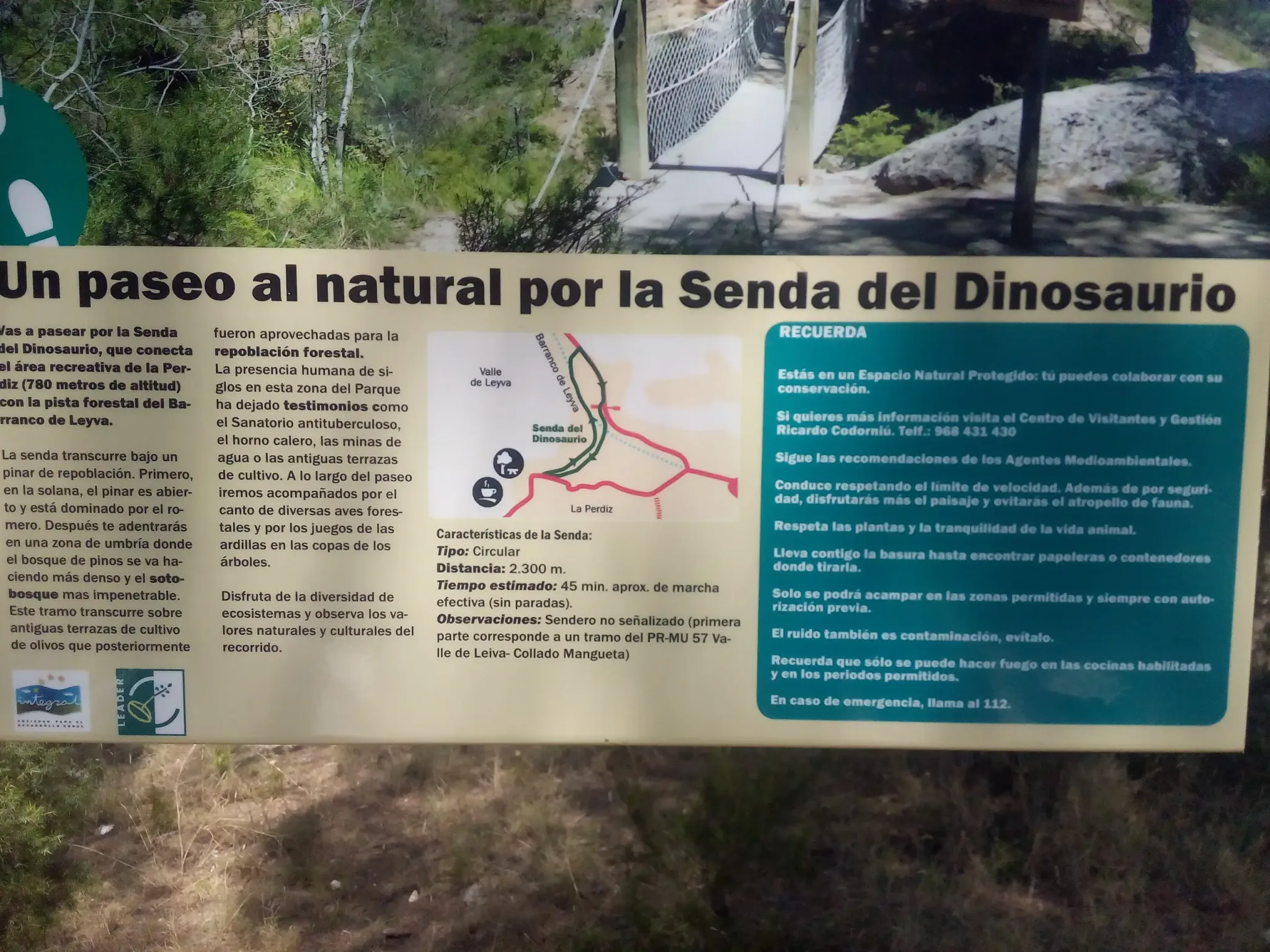
The Dinosaur Trail is a compact circular walk from La Perdiz recreation area into the pine-covered landscape below the Leyva ravine. It begins at about 780 metres above sea level and links the recreation area with the forest track through the ravine. The route is short enough for a relaxed outing, but it still gives a varied introduction to Sierra Espuña’s plants, wildlife and human history.
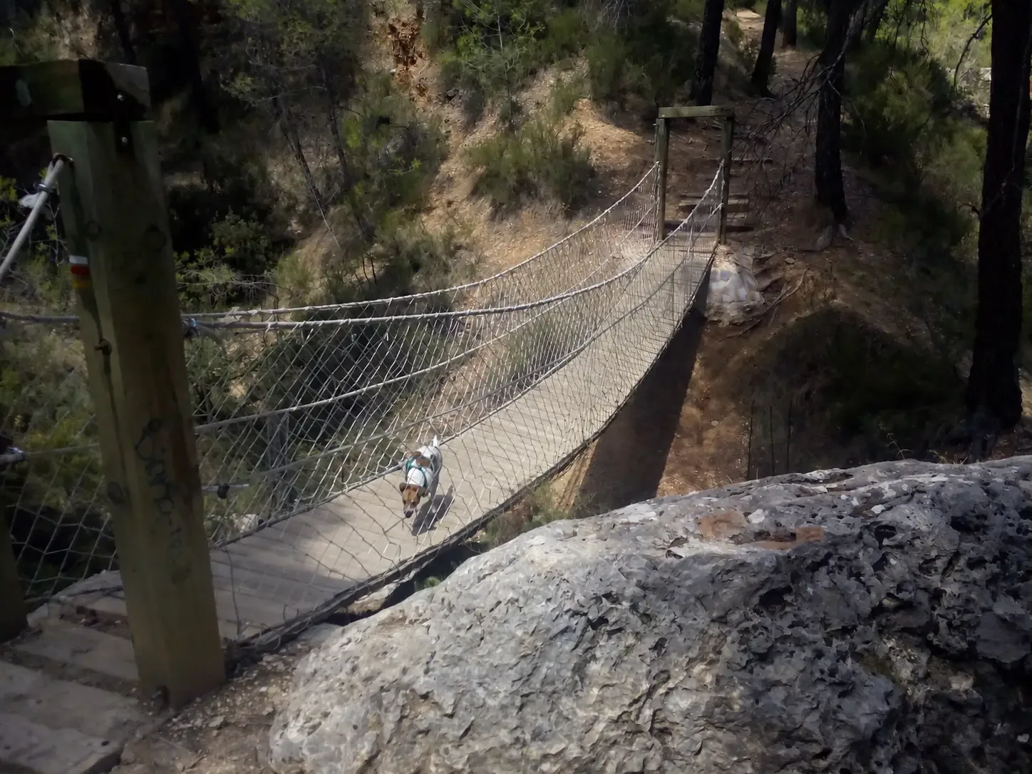
The suspension bridge is the trail’s most recognisable feature and gives the route a clear sense of adventure. The trail gets its name from a rock close to the bridge with a mark that resembles a dinosaur footprint. The official description presents it as a resemblance, so this is a nature and heritage walk rather than a palaeontological site.
What the route is like
The first slopes are sunny, with widely spaced replanted pines and rosemary across the drier ground. The route then enters a cooler, shadier section where the pine forest becomes denser and the undergrowth thicker. It also crosses old olive-growing terraces that were later replanted with trees, showing how the landscape has changed over time.
Although the distance is modest, expect an uneven mountain path rather than a surfaced promenade. Wear suitable walking shoes, carry water and use sun protection. Conditions can change quickly in the hills, and the shaded woodland can feel very different from the exposed opening section.
Natural and cultural clues
Listen for woodland birds and look into the treetops for squirrels without approaching or feeding them. The wider area also retains evidence of centuries of human activity, including old agricultural terraces, a lime kiln, water-collection tunnels and the former tuberculosis sanatorium.
These traces are easy to overlook if the walk is treated only as a quick circuit. Allow time to read the information board and notice how the vegetation, land use and shade change around the route.
Planning the walk
The circuit is 2.3 km. The trail board estimates approximately 45 minutes of walking time, excluding stops, so allow 1–1½ hours for photos, the bridge and pauses along the way. The complete route is not waymarked. Its first section follows part of the PR-MU 57 route between Valle de Leiva and Collado Mangueta, so save the official route information before starting.
La Perdiz recreation area is the practical starting point and has designated parking and picnic tables. For current route conditions, ask at the Ricardo Codorníu Visitor and Management Centre or call 968 431 430. Combine this page with our wider Sierra Espuña Regional Park guide when planning the rest of the day.
Dogs and park rules
Dogs can join the walk when kept under control and on a lead. Carry water for them and prevent them from chasing wildlife or disturbing other visitors. Keep all rubbish with you until you reach a bin, avoid unnecessary noise and leave plants and animals undisturbed.
Camping is permitted only in designated areas with prior authorisation. Fires may be lit only in authorised cooking facilities and during permitted periods; temporary fire restrictions can be stricter. Follow ranger advice and on-site signs, and call 112 in an emergency.