Murcia has a varied Mediterranean shoreline: open sandy beaches, shallow water around the Mar Menor, rocky ground around Águilas, Mazarrón and Cartagena, and two major marine reserves. That variety creates plenty of shore-fishing options, but it also means that a licence alone is not enough. You must check the fishing rules, the protected-area map and the municipality’s beach restrictions for the exact place and date.
Fishing regulations, protected areas and local restrictions can change. This guide is intended as a practical overview; always check the latest official regulations before fishing.
Do you need a fishing licence?
Yes. To fish recreationally from the shore in the Region of Murcia, anyone aged 14 or over needs the regional licencia de pesca marítima de recreo desde tierra. The current CARM procedure says this shore licence is valid for three years from issue and is granted indefinitely to people over 65. It also sets out parental or guardian authorisation for relevant minors.
Children under 14 may fish only when accompanied by an adult who holds the required licence. Carry the licence and identification while fishing.
The safest route is the official CARM shore-fishing licence procedure (opens in a new tab), which supports online and in-person applications. Check the live procedure for the current fee rather than relying on an old price copied elsewhere.
Catch reporting from 2026
CARM states that, from 10 January 2026, licensed recreational sea anglers must electronically record and report catches, including fish returned to the water and days on which nothing was caught. Its current guidance directs anglers to the national PescaREC mobile service and says the obligation applies to shore, boat and underwater licence holders.
Check the current CARM PescaREC guidance (opens in a new tab) before setting out. It also points users towards current minimum sizes, closed fisheries and species-specific authorisations.
The basic shore-fishing rules
For ordinary fishing from land, CARM’s current licence guidance allows hook-and-line tackle with a maximum of two rigs per person. Recreational catches are for personal consumption, charitable or social purposes, or return to the sea; they cannot normally be sold.
The regional summary states a general maximum of 5 kg per person per day, with one fish allowed not to count towards that weight. Species-specific limits, closures and protected-species rules can be stricter and take priority.
Only authorised fish and cephalopods may be taken. The capture of crustaceans, molluscs and other marine invertebrates is prohibited, apart from authorised cephalopods. Do not collect shellfish, crabs or other shoreline animals as bait.
Where can you fish?
Permission is determined at several levels: general fisheries law, environmental protection, marine-reserve zoning, municipal beach rules and port or harbour control. Check all that apply.
| Area type | What it means in practice |
|---|---|
| Open rocky coastline | Often the most straightforward type of ground outside a reserve or specifically prohibited area, but verify access, protected habitats and the official CARM map first. Rocks can become unsafe in even moderate swell. |
| Sandy beaches | Municipality and season matter. Fishing is commonly restricted or prohibited where bathers are present, sometimes throughout the summer or during bathing hours. |
| Harbours and ports | Never assume a wall or breakwater is open to anglers. Port authorities control their service areas, operational quays and access. Cartagena’s 2026 port ordinance treats fishing without the required authorisation as an offence. |
| Marine reserves | Each reserve is divided into zones with different rules. A licence does not override a reserve prohibition. Use the current official zoning map, not an unverified fishing map. |
| Mar Menor and protected coastal sectors | Some conservation zones prohibit recreational fishing from shore, boat and underwater. CARM publishes separate maps for Águilas, Mazarrón, Cartagena and the Mar Menor/Cabo de Palos/La Manga area. |
| Bathing and navigation channels | Keep out of marked bathing areas, boat-launch channels, port approaches and other navigational channels. These are safety zones, not convenient casting gaps. |
Shore-fishing areas and access considerations
The entries below describe useful areas to investigate, not blanket permission to fish at every point within them. Check the official prohibited-zone map and local signs at the access point on the day.
Águilas coast
The municipality has long stretches of rocky and mixed shoreline as well as popular beaches. The Águilas beach ordinance prohibits rod fishing within 100 metres of a beach during the high season, allowing it only on breakwaters, cliffs, sea walls and comparable places without regular bathing use. Outside high season, normal fisheries and protected-area rules still apply.
In practical terms, look for legally accessible rocky ground away from bathing areas, check the sea state carefully and do not interpret a harbour wall as public fishing access.
Mazarrón and Puerto de Mazarrón
The Mazarrón coast includes sand, rock and mixed ground, but its beach rules are specific. The municipal ordinance prohibits fishing from the shore on beaches and bathing areas unless the council has expressly enabled a zone or period; fishing from a groyne requires at least 30 metres’ separation from the shore.
The council’s official fishing-zone plan dated 22 July 2026 (opens in a new tab) is the clearest reference for Puerto de Mazarrón and the rest of the municipal coastline. It marks each coastal section in three colours:
- Green: fishing is permitted all year, 24 hours a day, provided no bathers are present; bathers take priority.
- Yellow: from 1 June to 30 September, fishing is permitted from 22:00 to 07:00; from 1 October to 31 May it is permitted throughout the day when the required separation from bathers is maintained.
- Red: fishing is prohibited at all times.
There is one official-source discrepancy worth knowing about. The July 2026 plan says anglers must remain at least 30 metres from bathers on yellow sections outside summer, while the council’s current accompanying fishing page (opens in a new tab) says 50 metres. Until the council aligns the wording, use the safer 50-metre distance and follow the plan, current beach signs and any instruction from lifeguards or police.
Do not turn a beach name into blanket permission: several beaches are split into differently coloured sections. The plan is designed to show those boundaries. Playa de Las Moreras is a dog beach and is marked as a no-fishing section.
La Azohía and the Cabo Tiñoso area
The coast west of Cartagena has attractive rocky ground, but much of the water lies within the Cabo Tiñoso marine reserve. The official zoning divides the reserve into cells A–D. MAPA’s current use table shows recreational fishing prohibited in cells A, B and C and permitted in cell D. The boundary is not obvious from the shore: consult the official map and confirm your position before unpacking tackle.
La Azohía is a useful reference point for understanding this stretch of coast, not a statement that fishing is permitted beside the tower, beach or harbour.
Cartagena’s open coast
Outside the two marine reserves and mapped conservation exclusions, Cartagena has sandy, rocky and mixed sections. During the bathing season, the council prevents shore and underwater fishing in bathing zones. Calblanque has additional environmental controls and recreational fishing there requires authorisation from the regional environmental authority, with applications restricted to the first two months of the year under the published access resolution.
The commercial port is separately controlled. Do not fish from operational quays, restricted breakwaters or port service land without explicit permission.
Cabo de Palos and Islas Hormigas
This reserve changed materially in May 2026. Decree 31/2026 expanded the protected water and created cells A, B and C. In the interior-water part of the reserve:
- all fishing is prohibited in the integral reserve, cell A;
- fishing from land is currently permitted in cells B and C, subject to the decree and other rules;
- boat and underwater recreational fishing are prohibited in cell C;
- within four years of the decree taking effect, shore fishing in cells B and C is due to become catch-and-release only, with catch information required.
This is exactly the sort of place where old web pages and old maps can be wrong. Use the May 2026 BORM decree and the latest CARM reserve map before fishing.
Mar Menor
Do not treat the Mar Menor as one unrestricted fishing area. The 2019 integrated management plan prohibits recreational fishing in the reserve zone and in named priority-conservation areas, including submerged fringes around the Mar Menor islands and other protected seabed sectors. Shallow water, bathing use, navigation channels and municipality-specific beach rules add further constraints.
Use CARM’s dedicated Mar Menor/Cabo de Palos/San Pedro/La Manga prohibited-area map. Playa de Las Salinas can help orientate visitors around Los Alcázares, but is not presented here as a confirmed fishing mark.
Municipal beach-fishing times at a glance
Mazarrón is the only municipality found during this review with a current public colour-coded fishing plan. Other coastal councils publish useful rules and time windows in their beach ordinances, but these do not replace CARM’s protected-area maps or signs at the beach.
| Municipality | Published beach rule | Official information |
|---|---|---|
| Mazarrón | The July 2026 plan uses green, yellow and red coastal sections. Yellow sections allow fishing from 22:00 to 07:00 from 1 June to 30 September and all day from 1 October to 31 May when bathers are kept clear. | Open the July 2026 zone plan (PDF) (opens in a new tab). Use a 50-metre bather margin while the plan and accompanying council text disagree between 30 and 50 metres. |
| San Javier | In bathing zones during high season, shore and groyne fishing is permitted only from 21:00 to 07:00, provided it does not interfere with beach cleaning or other users. Ports and their service areas require express authorisation. | Read San Javier council’s beach-fishing guidance (opens in a new tab). |
| Los Alcázares | In bathing zones, shore and groyne fishing is permitted only from 22:00 to 07:00 and remains conditional on there being no beach users. Ports and their service areas require express authorisation. | Read the Los Alcázares beach ordinance (BORM PDF) (opens in a new tab). |
| San Pedro del Pinatar | Fishing is prohibited in bathing zones from 1 June to 30 September. The ordinance does not publish an equivalent colour-coded angling map. | Read the San Pedro del Pinatar beach ordinance (BORM PDF) (opens in a new tab). |
| Águilas | During high season, rod fishing is prohibited within 100 metres of a beach except from breakwaters, cliffs, sea walls and comparable places without regular bathing use. | Read the Águilas beach ordinance (BORM PDF) (opens in a new tab). |
| Cartagena | The council prohibits shore and underwater fishing in bathing zones during the summer season. Its public guidance does not give a single municipality-wide night-fishing window, so check signs and current council notices for the specific beach. | Read Cartagena’s municipal beach guidance (opens in a new tab). |
Common shore-fishing methods
Ledger or bottom fishing
A weighted rig holds bait on or close to the seabed. This is the usual simple approach from sand or mixed ground. Keep the setup appropriate to the conditions and avoid leaving lost line, hooks or weights. Two rigs per person is the regional maximum, not a target that must always be used.
Float fishing
Float tackle can present a bait above rocky or weedy ground and makes the bite easier to see. It is often more manageable than a heavy bottom rig where snags are likely, provided there is enough safe space behind and beside you to cast.
Lure fishing
Small plugs, soft lures and metal lures can cover water from open shore. A lure counts as hook tackle under the regional rules. Keep clear of swimmers, boats and other anglers; a crowded beach or harbour entrance is not made safe by using a lightweight lure.
Bait
Tackle shops commonly sell marine worms and prepared fish, prawn or squid baits. Buy from a legitimate supplier and retain packaging if origin could be questioned. Do not gather molluscs, crabs or other marine invertebrates from the shore: CARM prohibits their capture for recreational sea fishing, except for authorised cephalopods.
Never release unused live bait or discard hooks, line or bait packaging on the coast.
Species you may encounter
Official regional and national material lists a wide range of authorised Mediterranean fish. Species associated with Murcia’s rocky, sandy and mixed inshore habitat include sea breams such as dorada and sargo, sea bass, mullet, mackerel and, around suitable rocky habitat, larger species such as dentex or grouper. Presence varies by ground, season and conditions; none should be treated as a promised catch.
Some species are protected, closed or subject to special authorisation and reporting. Correct identification matters. If unsure, handle the fish carefully and return it promptly.
Fish identification charts
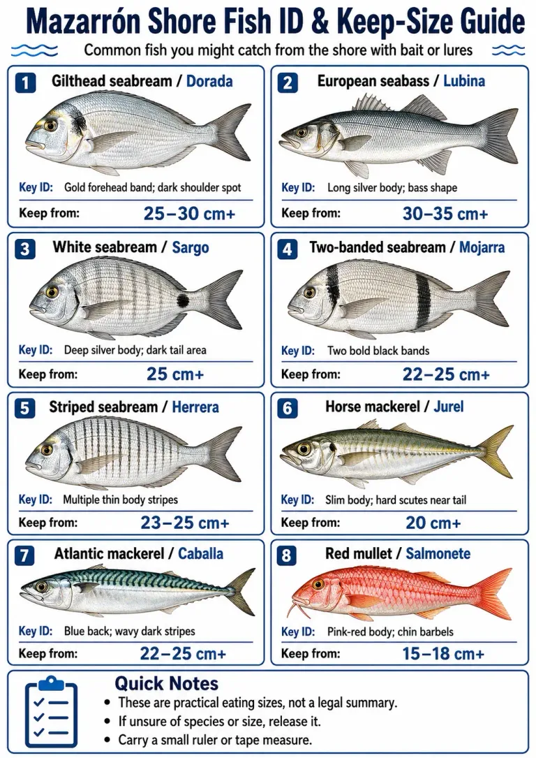
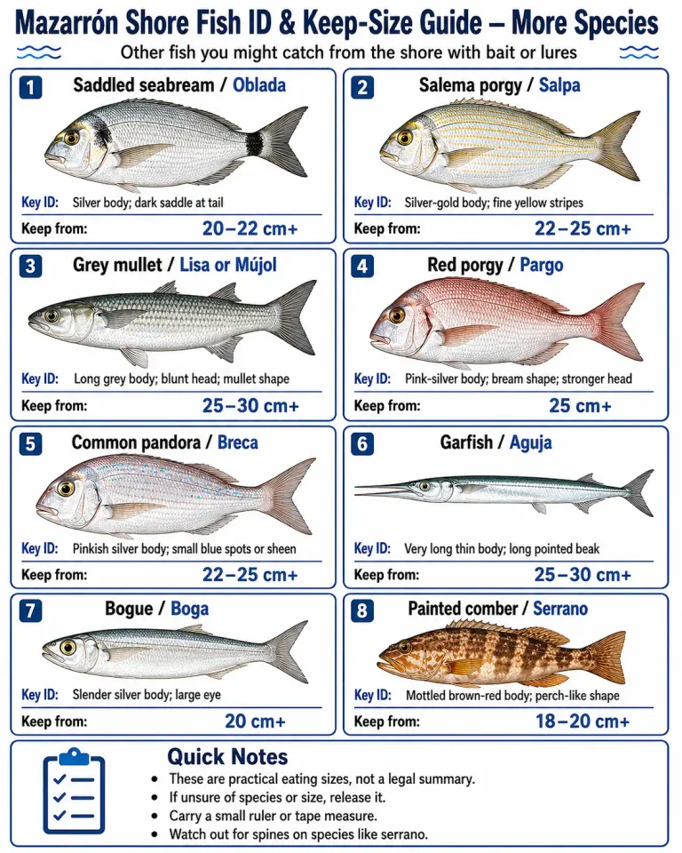
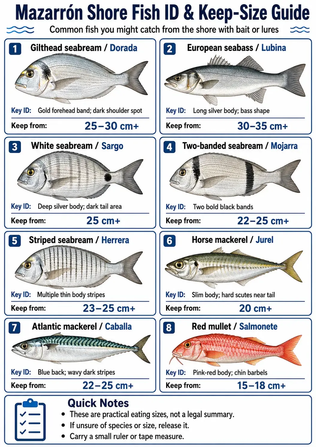
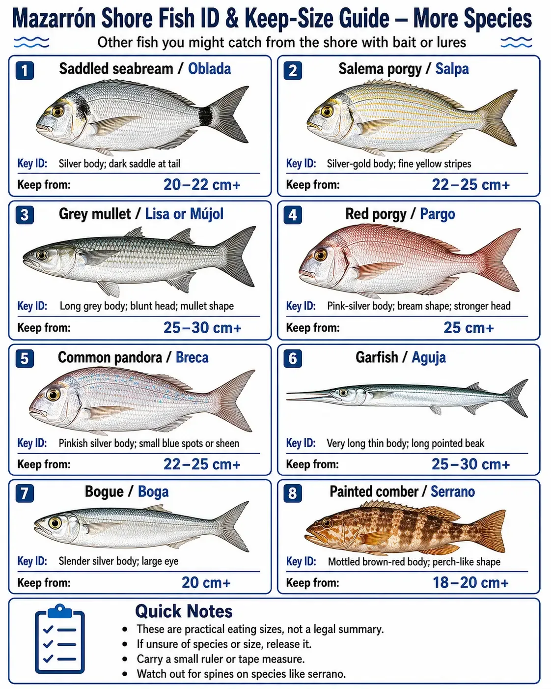
These illustrated charts cover common shore species around Mazarrón. Tap or click either chart to open a larger version.
The “keep from” figures on these charts are practical eating-size suggestions, not legal minimum sizes. They do not replace the current CARM rules, PescaREC information or the legal-size table below. If identification or size is uncertain, release the fish.
Minimum sizes, protected species and catch limits
The following examples come from CARM’s current shore-licence guidance. They are a quick check, not a replacement for the full live list in PescaREC or the current regulation.
| Species | Minimum size shown by CARM |
|---|---|
| Mojarra (Diplodus vulgaris) | 18 cm |
| Dorada (Sparus aurata) | 20 cm |
| Herrera / striped seabream (Lithognathus mormyrus) | 20 cm |
| Sargo (Diplodus sargus) | 23 cm |
| Lubina / European seabass (Dicentrarchus labrax) | 25 cm |
| Grouper species (Epinephelus spp.) | 45 cm |
Measure fish as required by the current official rules and return undersized fish immediately. The normal 5 kg daily personal limit does not authorise retention of an undersized, protected, closed or otherwise restricted species. Certain species require separate authorisation or have their own catch rules.
Fishing from beaches
Assume that a beach used by swimmers has restrictions until you have checked. Even where night fishing is allowed in summer, set up only after the permitted time and leave before the bathing period begins. Keep a wide safety margin from anyone in the water, dog exercise areas, lifeguard equipment and access routes.
Local rules differ. Mazarrón and Águilas are good examples: their published ordinances use different distances and seasonal approaches. A rule remembered from one municipality cannot safely be applied to the next.
Ports, marinas and breakwaters
Ports combine deep water with moving boats, mooring lines, commercial work and restricted land. Murcia’s fisheries decree also prohibits recreational fishing in port access channels and marked navigation channels. Cartagena’s port ordinance requires authorisation for secondary activities such as fishing within its service area.
For an autonomous or private marina, ask the operator and obey signs or gates. Public pedestrian access to a promenade does not automatically include permission to fish from the adjoining wall.
Safety on rocks and open coast
- Check wind, swell and wave period, not just the chance of rain.
- Wear footwear with reliable grip; smooth limestone and algae become extremely slippery.
- Fish back from the waterline and identify an escape route before setting up.
- Avoid exposed rock ledges alone, particularly in darkness.
- Tell someone where you are going and when you expect to return.
- Keep hooks controlled while casting and leave generous space from swimmers, walkers and other anglers.
- Carry water, sun protection and a charged phone. Use 112 for an emergency.
Before planning a coastal morning, you may also find Weekly Markets in Murcia: Days, Locations & Times useful.